
Riverside Corridor Enhancement

🛣️ About the project
The 3 Street NE/NW corridor, nestled in the Riverside neighbourhood, serves as a vital transportation route and connection to residential, commercial, and community services for our community.
The Riverside Corridor Enhancement Project focuses on 3 Street North (NE/NW), a roughly two‑kilometre corridor through the Riverside neighbourhood. The road connects homes, local businesses, transit, and neighbourhood destinations, and is also used by people travelling through Riverside to access other parts of the city, seeing around 4,000 vehicles daily. Originally built as Highway 1, 3 Street North was designed for higher speeds and different traffic patterns than it serves today. It now functions as a neighbourhood collector, balancing local access, parking, transit, pedestrians, cyclists, emergency vehicles, and through traffic.
The roadway and underground infrastructure are now in very poor condition. Ongoing surface repairs are no longer effective due to aging utilities, drainage issues, and settlement. This project combines roadway renewal, deep utility upgrades, and safety improvements into a single, coordinated investment intended to last 30–50 years, helping avoid repeated construction and future disruption.
The $7.45 million surface project was approved in 2025. Approximately 98% of the funding comes from federal and provincial programs, with the remaining portion funded through existing City capital reserves and no direct impact on municipal property taxes. Because projects of this scale come around once-in-a-generation, we are asking for the public’s help in determining a design that works for area residents today, but also for residents who will use this design for the next 30-50 years.
No decisions have been made yet. We are asking for public feedback on a revised design for this corridor. Keep reading to learn more about how you can influence aspects of the design!

👉 [for those who want technical details]
👉 [easiest way to visualize]
🛻Real-world road comparison, 20 Street NE is the same width and function
👉 [see a similar street in use]
📌 Why this is being considered
Several factors come together on this corridor:
⚙️ Infrastructure condition
Since 2018, the City has recorded 276 service requests related to road condition, drainage, icing, and surface failures.
The area requires deep utility upgrades (water, sewer, storm, sanitary, gas, electric).
This new infrastructure addresses known issues, improves reliability, and prevents costly emergency repairs.
🚦 Safety and speeding
Between 2012 and 2021, there were 156 reported collisions, including 27 injury collisions and one fatality.
Speed data shows vehicles travelling above the posted limit, reinforcing long-standing community concerns about speeding and safety.
The proposed design incorporates traffic calming measures shown to reduce speed, reduce severity of accidents, and improve safety.
🔄 Long‑term planning
Coordinating underground and surface work now helps reduce emergency repairs, repeated road closures, and long‑term disruption to residents and businesses.
🚶♀️Neighbourhood preferences
Engaging with the residents and businesses throughout this project to understand trade-offs and needs to come up with a design that works for all.
🎯 Project goals
The primary driver of this project is improved safety for all users, informed by resident feedback, traffic data, and collision history. At the same time, the project addresses infrastructure reliability and how the corridor functions day‑to‑day.
Safety 🚥
Use proven design standards that support safer vehicle speeds
Improve pedestrian visibility and shorten crossing distances
Provide consistent lighting throughout the corridor
Accessibility & connectivity 🚶♀️🚴
Include a multi‑use pathway shared by pedestrians, cyclists, etc.
Improve accessibility for seniors, families, and people using mobility devices
Support connections to the city‑wide trail network for everyday trips, not just recreation
- Maintain parking as is throughout
User experience & infrastructure reliability 🌳
Reduce recurring potholes and surface failures
Preserve all mature trees
Improve drainage to reduce ponding and icing
Add targeted amenities such as benches, garbage receptacles, bike racks, and upgraded bus stop pads
Maintain access to local businesses for customers, deliveries, and transit users
The project aligns with ‘complete streets’ designs balancing traffic calming principles, promoting active modes of transportation, and maintaining the functionality of this arterial roadway for vehicle traffic. To learn more about the 'complete streets' concept, check out these design standards. You can also read this case study paper on complete streets.
🗣 What we’ve heard so far
The first phase of engagement collected feedback from the community on the conceptual design. Feedback focused primarily on safety, road function, parking, construction impacts, and trust in the process.
❓ Clarity and trust – To work together on determining an accepted design for the neighbourhood, to feel heard and improve communication, and see how feedback is used to refine the design.
🚦 Speeding and pedestrian safety – Concerns about vehicle speeds, collision risk, and feeling unsafe crossing the street in certain locations.
📏 Road width and maneuverability – Questions about emergency access, large vehicles and trailers access, winter driving conditions, and neighbourhood feel with the proposed road width.
🚸 Crossings and bulb‑outs – Desire for safer, more visible crossings, alongside concerns about too many bulb‑outs and turning radius.
🚶♀️🚴 Multi‑use pathway – Interest in accessibility and connectivity, with differing views on trail location and intended use.
🚗♿ Parking and access – Ongoing concern about maintaining on‑street parking for residents, businesses, customers, and accessible users.
💡 Lighting and amenities – Interest in improved lighting and basic amenities, especially near the commercial district and bus stops.
🌳 Boulevard landscaping – Preference for green, tree‑lined streets, with questions about maintenance responsibilities and winter conditions for trails and boulevards.
👷 Construction impacts – Access, duration, communication, and business impacts during construction.
💰 Value and proportionality – Questions about whether this is a necessary and proportionate long‑term investment.
🔄 What has changed since the first concept design
Based on public feedback received after the April 2025 concept design, the project has moved into Phase 2, with the following key refinements:
✅ All deep utilities will be upgraded, reducing the need for future excavation
❌ Removal of the roundabout.
❌ Removal of 57 total bulb‑outs
✅ Only 7 bulb‑outs remain, located at high‑priority pedestrian crossings
✅ Remaining bulb‑outs have been significantly relaxed to allow smoother turns
↔️ 8 of 15 intersections remain as is, providing ample turning space for larger trucks and trailers
🚸 7 enhanced pedestrian crossings, including 5 with rapid flashing beacons and accessibility features
🚗 The same amount of on‑street parking as exists today, with all accessible/loading stalls preserved
💡 Improved lighting and added amenities in key areas, including the business district
🌳 Boulevard landscaping will be determined block‑by‑block, with a preference for green landscaping
📊 How decisions are made
This phase of the project shows a second revised design and offers an opportunity for residents to weigh-in on a variety of design features through the online survey.
Final decisions on this project will consider:
Community feedback
Traffic and collision data
Engineering and accessibility standards
Long‑term infrastructure performance
Funding and regulatory requirements
While not all feedback can be incorporated, it directly informs how trade‑offs are evaluated. City Council will be presented with the public’s feedback to help inform future decisions and design for this project.
When planning safer streets, traffic safety is commonly viewed through the “3 Es” framework:
Engineering – how the street is built, including road width, crossings, curbs, and lighting
Education – helping people understand what to expect on the road through visibility, clear layouts, and predictable design
Enforcement – speed limits, rules of the road, and policing
While enforcement and education are important, changes to the physical design of the street are proven to be one of the most effective ways to reduce vehicle speeds and the severity of collisions. That is especially true on long, wide roads where enforcement alone is limited.
Community feedback has consistently highlighted concerns about speeding along this corridor. During the development of the Riverside Neighbourhood Plan, residents raised issues about traffic speeds and safety, particularly for children, seniors, and other vulnerable road users. These concerns are echoed in ongoing service requests and collision data and speed maps all pointing to a need for infrastructure improvements on this stretch of road.
In addition to public feedback and data, this project is guided by established plans and standards. The City’s Municipal Development Plan supports safe travel and active transportation as the city grows, and is guided by the draft Transportation Master Plan. Road design and safety features also follow national standards set by the Transportation Association of Canada, ensuring the corridor meets recognized safety and accessibility requirements.
Some elements must meet engineering, safety, and accessibility standards and are not open to change. Other elements can still be refined, and those are the focus of this phase of engagement.
🤝 Who is involved
Riverside is one of the oldest and most diverse neighbourhoods within the City of Medicine Hat. This project directly impacts the residents and businesses of the Riverside neighbourhood, but also impacts commuters and drivers who frequently use 3rd Street as a connection to the various facilities in the area, including our historic downtown area.
Residents and businesses along 3 Street North
Community organizations, including the Riverside Neighbourhood Association
People who use the corridor regularly
City staff and engineering consultants
City Council
✅ How to get involved
1. 📄 Review the project materials
Before completing the survey, please:
2. 🏫 Attend an open house
Open houses will take place at Elks Hall (305 3 Street NW, Medicine Hat). City staff and project team members will be available to answer questions and discuss elements that are still being refined.
Wednesday, May 27
🕚 11 a.m. – 1 p.m.
🕓 4 – 7 p.m. (Riverside residents‑only session)
Please note: This evening session is being held in collaboration with the Riverside Neighbourhood Association’s annual BBQ and may be busy. Residents who prefer longer conversations, or who have hearing or mobility considerations, are encouraged to attend one of the other open house times.
Tuesday, June 2
🕚 11 a.m. – 1 p.m.
🕓 4 – 6 p.m.
3. 📝 Complete the survey
The survey is open May 13 to June 15, 2026 (closes at 11:00 p.m.)
It takes approximately 25 minutes to complete – all questions are optional and anonymous
If you have a printed copy of the survey, please return it to customer service at City Hall by before Monday, June 15 at 4:30 p.m.
Completing the survey formally records your feedback. Survey results will be summarized and shared publicly after the survey closes.
 |  |  |
⏭️ What’s next
Survey feedback will be summarized and shared publicly this summer
Design refinements will continue toward final detailed design
Construction is tentatively planned to begin in 2027
Timing is subject to funding agreements, weather, and final approvals

Level of Engagement

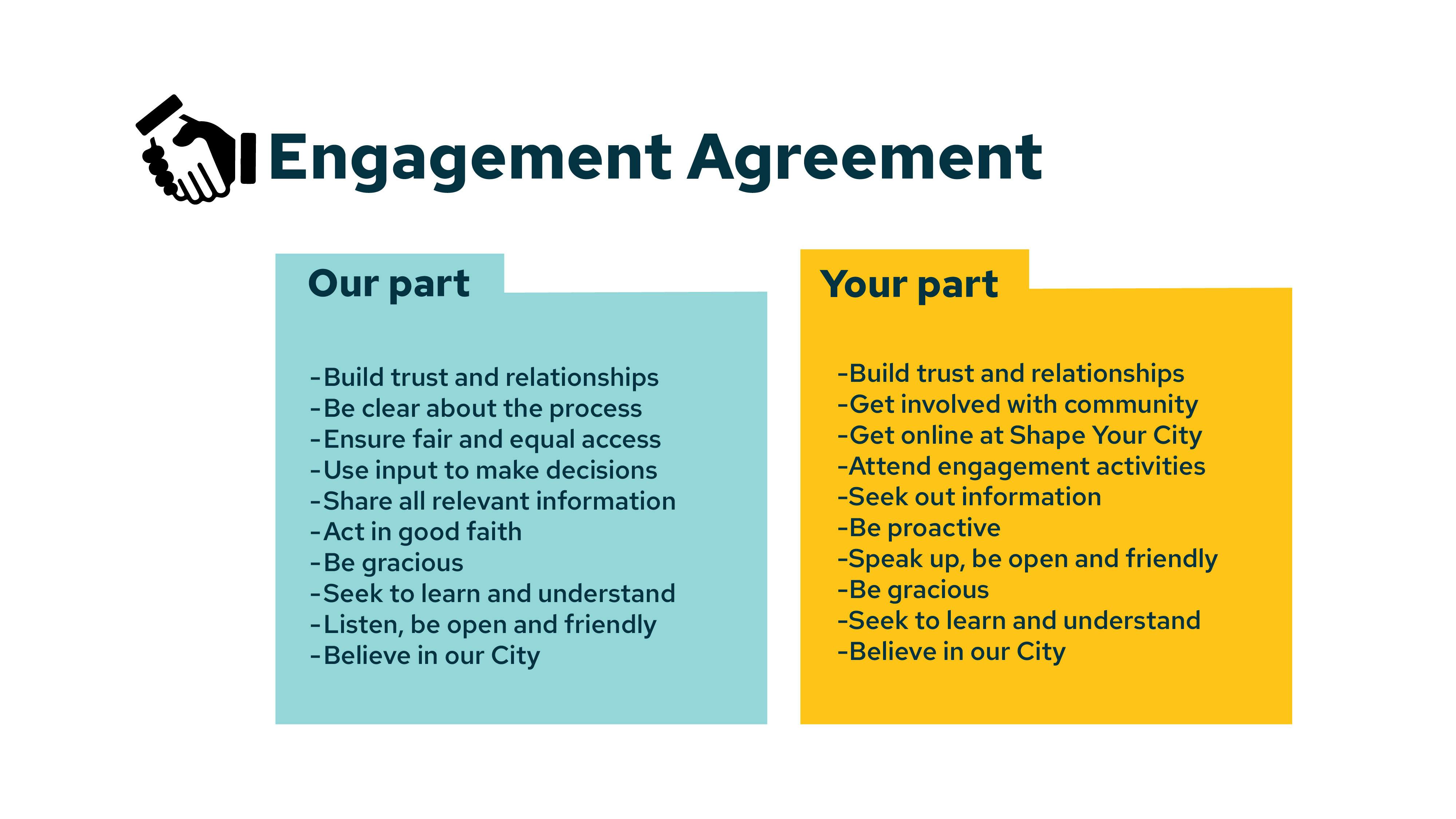
Engagement Agreement
Phase 2: Revised design

FAQs
-
 Design FAQ
- Will I lose any parking adjacent to my residence?
- What is the purpose of a round-about at the intersection of 3rd Street and 2nd Avenue NE?
- Can every crosswalk also have a ‘push button’ flashing light installed?
- Why aren’t the deep utilities including the water and sewer included in this project?
- Why aren’t crosswalks proposed on every block?
- How many trees are expected to be removed to fit the multi-use path within the right-of-way?
- Will the City be conducting Snow Removal of the Multi-use path in front of my house?
- Will I be able to safely navigate the intersections without hitting the curb or entering the oncoming lane of traffic?
- Will this project be incorporating improvements to the boulevard area specific to the landscaping adjacent to my property? And will the City be extending my existing walkway to connect to the new MUP?
- Why is the road being “narrowed?”
-
Construction FAQ
- What happens if construction causes damage?
- How will businesses be kept informed during construction?
- Will businesses receive financial relief during construction?
- How will delays be prevented or addressed?
- How is construction timing being managed?
- How will signage, parking, and advertising be handled?
- How does the City’s tendering process work?
- Why can’t the City commit to firm construction dates right now?
- Will local contractors be prioritized?

